Sowing the seeds of agricultural change…with the newspace economy ?
The agricultural sector today is grappling with a wide range of challenges. Faced with increasing pressures from climate change, soil erosion, biodiversity loss and unacceptable waste – to name but a few – farmers must also contend with changing consumer preferences, and the evolving expectations of governments and regulators.
While it’s clear that reform is necessary, how this can be achieved is less straightforward. Farmers need to be able to do more, with less resources, all while preserving the ability to maintain their livelihoods. Factors such as economic instability, social inequalities, geopolitical strife, and intense competition for natural resources are only further complicating matters.
We speak to Eric Benoist to discover where the sector could benefit from advances in technology, and how these may be funded.

Eric Benoist
Tech & Data Research Specialist
With all the challenges facing the agriculture industry globally, are we on the verge of a major food crisis?
According to various estimates, the global population is projected to surpass 10 billion by 2060. This growth, along with rapid urbanization and increasing average incomes in developing countries, is expected to bring about significant shifts in dietary preferences. These changes will likely lead to higher consumption of meat, dairy, fruits, and vegetables, as opposed to cereals, along with an increase in overall caloric intake. To satisfy this new demand, substantial adjustments in production capacity and output will be necessary. The Food and Agriculture Organization of the United Nations (FAO) estimates that by 2050, global agriculture will need to produce nearly 50% more food than it did in 2012, with production in South Asia and sub-Saharan Africa needing to more than double.
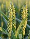
In addition to this, it is already evident that the farming model adopted by higher income countries in the 1950s is reaching its limits – we are seeing wheat, maize, and barley yields plateau in many parts of the world and, there is growing evidence that physical boundaries may have been reached that cannot be overcome with more fertilizers and pesticides.
50%
The estimated increase in food production required by 2050*
Climate change too poses a significant threat to agricultural production, including changes in temperature and precipitation, extreme weather events, sea level rise, etc...
So, while we are not yet on the brink of a food crisis, we do need to act urgently, to avoid catastrophe in the future.
How will change be affected?
The FAO has introduced an ambitious strategic framework summarized by what it refers to as the ‘Four Betters’ – better production, better nutrition, better environment, and better life – which places a strong emphasis on technology, data, and innovation.
From biotech, genomics, green chemistry, and robotics, to digital marketplaces and blockchain traceability solutions, there are many areas of scientific interest with the potential to bring meaningful progress to agriculture. Satellite imagery is another important example, long recognized by the FAO.
In 2020, the organisation set up an open-access platform as part of its Hand-in-Hand initiative to supply a wide range of geospatial data, tools and resources, and support more targeted interventions and decision-making in the fields of agriculture, forestry, fisheries, and food security. The data is sourced from leading public data providers across the UN, NGOs, academia, private sector, and space agencies and already helps countless industry experts, economists, farmers, and educators extract substantial value from the skies.
So, if we focus on newspace technology, where do we see the best opportunities for agricultural progress?
There are multiple areas that are showing significant promise.
One is the use of satellites for precision farming and irrigation, providing unique insights into what is happening in the field, across every stage of the growing cycle. Specific use cases include the detection of diseases, safeguarding crops from insect infestations, addressing nutrient deficiencies, and mitigating the impact of weeds. While it may sound simple, the stakes are high: according to the FAO, up to 40% of crops are lost each year due to pests and diseases, costing the global economy over $220bn. With the right intelligence from space, precision techniques such as variable-rate spraying provide an effective remedy, while reducing the cost of chemical inputs by 10 to 30% and increasing farmers' profit margins. The same applies to irrigation. According to the WWF, agriculture uses 70% of the world’s accessible freshwater, but some 60% of this is wasted due to inadequate infrastructure and practices.

USD 220 bn +
The cost to the global economy as a result of crops lost to pests and disease
Space imagery can also be used for disaster prevention and management, including predicting and monitoring floods, droughts, storms, and wildfires, which have been responsible for more than $3.8tn in crop and livestock losses over the past 30 years.
For Green House Gas emissions, advanced satellite spectrometers can help detect areas that require urgent remediation and monitor progress after corrective measures have been implemented.
Finally, satellite technology can be used to ensure that farms comply with regulatory requirements.
Spaceborne remote multispectral and hyperspectral sensors detect very subtle differences in the electromagnetic spectrum, making it possible to clearly identify, from an orbital position, small objects and features that would otherwise go unnoticed. The sector is rapidly expanding, and with the ongoing democratization of access to space, many companies have entered the market with ambitious roadmaps.
Advances in Earth observation technologies show significant promise to benefit the agricultural industry, amidst the multitude of challenges it faces today. The use of satellites for precision farming and irrigation, hyperspectral imagery for disaster prevention and the monitoring of Green House Gas emissions. But all this requires significant funding, something that the private sector alone will likely not be able to achieve.
No doubt there is a significant cost attached to many of these technologies – way beyond the capacity of many farmers. Who can/should be funding these advancements?
It's true that farmers suffer from considerable volatility in their incomes and net revenues from one year to the next, and that in a context of tight margins, they don't always have sufficient financial resources to invest in the tools needed to keep the sector moving forward.
Price references range from 2€/km2 for a low-quality hyperspectral image to 35€/km2 for a very high-quality hyperspectral image. With additional processing, the bill increases sharply, depending on the complexity of the requested service. Of course, a single image is rarely enough to make a decision, and at certain times of the year, long sequences taken over several days or weeks may be needed to assess a situation properly. It goes without saying that any urgent demand requiring immediate prioritisation of satellite resources incurs additional costs. For regular users, subscription plans may be available, but the financial burden is likely to remain substantial.
While it seems probable that raw geospatial data will become increasingly accessible, cutting-edge services with high added value will probably remain out of reach of the users who need them most (at least, in the agricultural domain).
If the farmers won’t (or can’t) pay, we see two viable possibilities: large agrifood companies (which tend to be large consumers of satellite imagery) and government agencies (which regularly call on private technology providers to improve the depth and quality of their services).
But ultimately, agriculture only represents a small segment of the commercial opportunity for Earth Observation and there is a risk that companies in the sector may shift their attention to more lucrative industries – such as Defense or Mining – to satisfy the ROI requirements of their investors.
Considering the enormity of the challenge, the private sector can only achieve so much on its own: the most viable short-term solution still lies in releasing more public funds, perhaps in the form of more systematic Public-Private Partnerships (PPP), but this entails intense and prolonged political efforts, and is no easy feat in today’s uncertain geopolitical environment.